News
- The CDL GEOHUM is organising a session on 𝘎𝘦𝘰-𝘧𝘰𝘶𝘯𝘥𝘢𝘵𝘪𝘰𝘯 𝘢𝘯𝘥 𝘨𝘦𝘯𝘦𝘳𝘢𝘵𝘪𝘷𝘦 𝘮𝘰𝘥𝘦𝘭𝘴 𝘧𝘰𝘳 𝘌𝘖-𝘣𝘢𝘴𝘦𝘥 𝘪𝘯𝘧𝘰𝘳𝘮𝘦𝘥 𝘥𝘪𝘴𝘢𝘴𝘵𝘦𝘳 𝘳𝘪𝘴𝘬 𝘳𝘦𝘴𝘱𝘰𝘯𝘴𝘦 at IGARSS2026 || Washington D.C., USA || 9-14 August 2026.
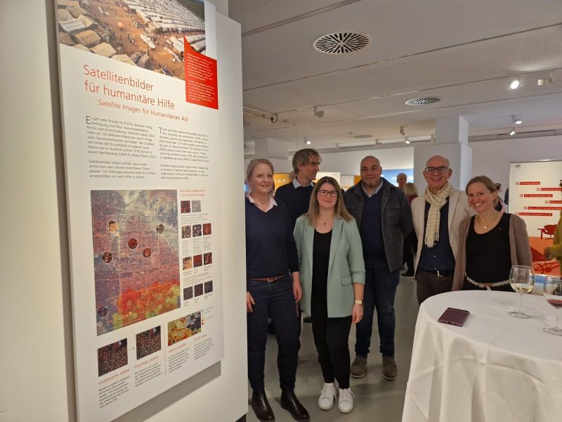
- The CDL GEOHUM, in collaboration with Ärzte ohne Grenzen Österreich and Spatial Services GmbH, has contributed to a “regional” section to the DLR designed exhibition ALL.täglich! – Haus der Natur, drawing on their combined expertise in Earth observation (EO)-based humanitarian applications. The exhibition will be open until 10 April 2026.
- Our colleague Bruno Menini Matosak contributed to the CDG Science Slam 2025 explaining how AI can be used to enable Médecins Sans Frontières (MSF) to provide even more efficient aid during flood disasters. Watch the video here: CDG-Science-Slam 2025: AI for Disaster Relief
Presentations
- Generative Approach for Building Change Detection in Temporary Settlement Areas for Humanitarian Emergency Response. Getachew Gella Workineh, IGARSS 2025, Brisbane, Australia, 03.08.2025.
- Co-developing geospatial research and innovation for humanitarian action – the Christian-Doppler lab GEOHUM. Stefan Lang and Yann Rebois, AGIT conference, Salzburg, Austria, 03.07.2025.
- Advances in deep-learning models for building extraction vs. operational constraints. Getachew Gella Workineh and Ahmad Alobaidi, AGIT conference, Salzburg, Austria, 03.07.2025.
- Label Efficient and Uncertainty Aware Machine Learning for Improved Flood Mapping. Bruno Menini Matosak, AGIT conference, Salzburg, Austria, 03.07.2025.
- Integrated Earth Observation-Based Indicators for Early Response to Drought-Induced Food Insecurity. Leizel de la Cruz, AGIT conference, Salzburg, Austria, 03.07.2025.
- Assessment of data quality of gridded population products. Sophia Klaußner, AGIT conference, Salzburg, Austria, 03.07.2025.
- Assessment of Biases in Crop Detection of Common Land Cover Producs in Sub-Saharan Africa. Sophia Klaußner, 44th EARSeL symposium, Prague, Czech Republic, 26.-29.05.2025.
- SenForFlood: A New Global Dataset for Flooded Area Detection. Bruno Menini Matosak, 44th EARSeL symposium, Prague, Czech Republic, 26.-29.05.2025.
- Generative Models for Training Data Augmentation for Building Change Detection from Mono-temporal Images. Getachew Workineh Gella, 44th EARSeL symposium, Prague, Czech Republic, 26.-29.05.2025.
- Geospatial data integration to map social ecological complexity in poly crisis response. Stefan Lang, 3rd International Conference on Geographical Science for Resilient Communities, Ecosystems and Livelihoods under Global Environmental Change (GORILLA), Kampala, Uganda, 04.12.2024.
- Earth Observation for Humanitarian aid. Reid Taremwa, 3rd International Conference on Geographical Science for Resilient Communities, Ecosystems and Livelihoods under Global Environmental Change (GORILLA), Kampala, Uganda, 04.12.2024.
- GeoAI for biodiversity Conservation. Getachew Workineh Gella, 3rd International Conference on Geographical Science for Resilient Communities, Ecosystems and Livelihoods under Global Environmental Change (GORILLA) [Preconference event], Kampala, Uganda, 01.12.2024.
- GeoAI: Unlocking the Potential of Earth Observation Imagery under the theme: “Mapping Minds, Shaping the World: 25 Years of GIS Excellence”, Getachew Workineh Gella, Opening keynote at GIS Day, Bahir Dar University, online, 23.11. 2024.
- Applications of Remote Sensing in Environmental Protection and Humanitarian Action – the Christian Doppler Laboratory GEOHUM. Lorenz Wendt, Asia Pacific Economic Cooperation (APEC) Senior Official’s Meeting (SOM3), 16.08.2024.
- Leveraging Mono-temporal Images for Building Change Detection in Temporary Settlement Areas: Applications in Humanitarian Emergency Response. Getachew Workineh Gella, AI4EO symposium 2024 at International Future Lab, Technical University of Munich, Germany, 16.07.2024.
- Deep Learning for Cross-Domain Building Change Detection from Multi-Source Very High Resolution Satellite Imagery. Getachew Workineh Gella, International Symposium on Geoscience and Remote Sensing (IGARSS), Athens, Greece, 08.07.2024.
- Evaluating Geospatial Data Adequacy for Integrated Risk Assessments: A Malaria Risk Use Case. Sophia Klaußner, 43rd EARSeL Symposium, Manchester, United Kingdom, 19.06.2024.
- Earth Observation for Humanitarian Action. Lorenz Wendt, NEREUS session: The safety and security dimension of space VII: Humanitarian aid, online, 03.04.2024.
- Segment Anything Model for Refugee-Dwelling Extraction with Few Samples from High-Resolution Satellite Imagery. Yunya Gao and Hui Zhao, 18th Conference on Location Based Services (LBS 2023), Ghent, Belgium, 20.11.2023
- Deep-learning-based refugee-dwelling extraction from high-resolution satellite imagery, Yunya Gao, IEEE International Humanitarian Technology Conference (IEEE IHTC), Cartagena, Colombia (Online), 01.11.2023.
- Segment Anything Makes It Easier to Produce Deepfake Satellite Imagery, Yunya Gao, International Data Week 2023, Salzburg, Austria, 23.10.2023.
- Opening Plenary: Welcome to IDW 2023 ‘Spatial Data Science: Geographic Context Matters’. Getachew Workineh Gella, International Data Week 2023, Salzburg, Austria, 23.10.2023.
- Mapping Climate, Conflicts, and Epidemics: Development and Evaluation of a Geospatial Risk Assessment for Healthcare NGOs, Linda Petuschnig, Climate-Induced Migration: New perspectives and methodological innovations Malmö, Sweden, 16.10.2023.
- Dwellings as anomalies: integrating VAEs for unsupervised object counting in humanitarian emergency response. Getachew Workineh Gella, Symposium of the International Future Lab AI4EO-2023, Technical University of Munich, Munich, Germany, 09.10.2023.
- PeaceEye in the context of human security, humanitarian action and peace tech. Stefan Lang, International Digital Security Forum (ISDF) Vienna, Austria, 20.09.2023.
- Maps Translated from Satellite Imagery by Image-To-Image Translation May Be More Unreliable due to the Advent of Segment Anything Model, Yunya Gao, International Symposium on Location-Based Big Data and GeoAI 2023 (LocBigDataAI 2023), Cape Town, South Africa (Online), 12.08.2023.
- Variational Autoencoders for Unsupervised Object Counting from VHR Imagery: Applications in Dwelling Extraction from Forcibly Displaced People Settlement Areas. Getachew Workineh Gella, International Geosciences and Remote Sensing Symposium (IGARSS) 2023, Pasadena, California, USA, 19.07.2023.
- Deep Learning Powered Non-Local Speckle Filtering of Sentinel-1 Imagery and Its Potential for Humanitarian Action. Getachew Workineh Gella, International Geosciences and Remote Sensing Symposium (IGARSS) 2023, Pasadena, California, USA, 18.07.2023.
- Integration of sparse multi-source earth observation data with deep learning for crop type and yield estimation in smallholder farming areas. Getachew Workineh Gella, 13th International Symposium on Digital Earth on Earth intelligence to understand and protect our Living Planet, Athens, Greece, 12.07.2023.
- Weakly Supervised Semantic Segmentation for Dwelling Extraction in Refugee Camps from Very-High-Resolution Satellite Imagery. Yunya Gao, 13th International Symposium on Digital Earth on Earth intelligence to understand and protect our Living Planet Athens, Greece, 11.07.2023
- People in need – How satellite data reveal food and nutrition demand, Stefan Lang, CIVIS Global Days, University of Tübingen, Germany, Neue Aula, 25.05.2023.
- Bewertung von Malariarisiko mittels Daten- und Kartenverschneidung, Linda Petutschnig, Simulation in den Umwelt- und Geowissenschaften Bayreuth, Germany, 02.03.2023.
- Towards a geoprivacy-aware sharing of very high-resolution satellite imagery for humanitarian applications, Getachew Workineh Gella, IEEE GRSS second workshop on Remote Sensing Data Management Technologies in GeoScience 2022 (RSDM-GeoSci 2022), Paris, France, 02.12.2022.
- Spatially Transferable Dwelling Extraction from Multi-Sensor Imagery in IDP/Refugee Settlements: A Meta-Learning Approach, Getachew Workineh Gella, International Symposium on Applied Geoinformatics 2022, Chania, Greece, 14.10.2022.
- R & geospatial data: identifying vulnerable populations at risk, Linda Menk, GeOnG 2022, Chambéry, France, 26.10.2022.
- Role of Emerging Technologies for Humanitarian Response: current advances and prospects of integrating AI with Earth observation?, Getachew Workineh Gella, GeOnG 2022, Chambéry, France, 26.10.2022.
- Earth observation to foster peace building, Stefan Lang, ASPR 40 Years Anniversary Ceremony and Conference, Schlaining, Austria, 05.10.2022.
- Why a session on Hybrid AI? Complementary research approaches in machine learning and the need for a common language to bridge between research domains and user domains, Stefan Lang, GI_Salzburg22, Salzburg, Austria, 06.07.2022.
- Building extraction in the humanitarian context: constraints, challenges and opportunities for hybrid AI experiments from 10+ years of data collection, Yunya Gao and Getachew Workineh Gella, GI_Salzburg22, Salzburg, Austria, 06.07.2022.
- Assessing the Influences of Band Selection and Pretrained Weights on Semantic-Segmentation-Based Refugee Dwelling Extraction from Satellite Imagery, Yunya Gao, AGILE 2022, Vilnius, Lithuania, 16.06.2022.
- Integration of open-source solutions with deep learning for estimating crop production in data-scarce smallholder farming areas, Gella, G. W., ESA Living Planet Symposium 2022, Bonn, Germany, 23.05.2022.
- Explainable AI for Humanitarian Action, Stefan Lang and Dirk Tiede, International Conference on Image Processing Theory, Tools and Applications (IPTA), Salzburg, Austria, 22.04.2022.
- Big data and humanitarian mapping, Stefan Lang, Afro-Asian Institute, public seminar, Salzburg, Austria, 20.1.2022.
- Geospatial and EO-based technology for humanitarian action, Stefan Lang, MSF Open Board Meeting, 27.10.2021.
- Mask R-CNN-Based Building Extraction from Satellite Data in Humanitarian Action, Dirk Tiede, ESRI User Conference 2021: GIScience session, online, 12.7.-15.7.2021.
- Suggestions on the Selection of Satellite Imagery for Future Remote Sensing-based Humanitarian Applications, Yunya Gao, Symposium of the International Society for Digital Earth 2021 – Special Forum on Humanitarian Action, Salzburg, Austria, 08.07.2021.
- Multi-feature Sample Database for enhancing Deep Learning Tasks in Operational Humanitarian Applications, Stefan Lang, Symposium of the International Society for Digital Earth 2021 – Special Forum on Humanitarian Action, Salzburg, Austria, 08.07.2021.
- Testing Transferability of Deep Learning-based Dwelling Extraction in Refugee Camps, Gella Getachew Workineh, Symposium of the International Society for Digital Earth 2021 – Special Forum on Humanitarian Action, Salzburg, Austria, 08.07.2021.
- Extraction of Dwellings of Displaced Persons from VHR Radar Imagery – Current Challenges, Future Perspectives, Andreas Braun, Symposium of the International Society for Digital Earth 2021 – Special Forum on Humanitarian Action, Salzburg, Austria, 08.07.2021.
- Evaluation of DEMs Derived from Multi-Date Satellite Stereo Imagery for Urban Areas, Lorenz Wendt, Symposium of the International Society for Digital Earth 2021 – Special Forum on Humanitarian Action, Salzburg, Austria, 08.07.2021.
- Determining mortality rate by counting graves in satellite images, Lorenz Wendt, Flavio Finger (MSF), MSF Scientific Day 2021, online, 10.06.2021.
- Mask R-CNN based Mapping of Dwellings in Refugee Camps from Very High-Resolution Satellite Imagery, Getachew Workineh Gella, 40th EARSeL symposium 2021, Warsaw, Poland, 08.06.2021.
- Mask R-CNN-Based Building Extraction from VHR Satellite Data in Operational Humanitarian Response – an Example Related to Covid-19 Response in Khartoum, Sudan, Dirk Tiede, Esri Imagery and Remote Sensing Educators Summit 2021, online, 29.04.2021.
- Supporting urban sanitation management through the integration of EO-based indicators, Barbara Riedler, EARSeL joint workshop 2021: Earth Observation for sustainable cities and communities, online, 1.4.2021.
- Flood mapping with radar, Andreas Braun, MSF GIS week 2020, 24.09.2020.
- Radar imagery for humanitarian action, Andreas Braun, MSF GIS week 2020, 01.10.2020.
Posters
- SenForFlood: A Global Dataset for Flood Mapping. EurIPS 2025: Workshop AI for Earth and Climate Sciences, Copenhagen, Denmark, B. M. Matosak, 02.-07.12.2025.
- Operationalization of EO-Derived Indicators for Early action on drought related food insecurity. ELLIS: AI for Earth and Climate Sciences, Jena, Germany, L. De la Cruz, 01.-05.09.2025.
- Assessment of Biases in Crop Detection of Common Land Cover Products in Sub-Saharan Africa. AGIT conference, Salzburg, Austria, S. Klaußner, 02.-03.07.2025.
- SenForFlood: A Global Dataset for Flood Mapping. AGIT conference, Salzburg, Austria, B. M. Matosak, G. W. Gella, S. Lang, 02.-03.07.2025.
- Assessment of Biases in Crop Detection in Large-Scale EO Landcover Products in Tanzania. ESA Living Planet Symposium 2025, Vienna, Austria, S. Klaußner, 23.-26.06.2025.
- Sentinel-1 SAR Data For Building Damage Assessment After The Turkey-Syria Earthquake, February 2023. FRINGE 2023, Jaggy, N., Dabiri, Z. , Braun, A., Jessen, L., Lang, S., Nafieva, E., Leeds, UK, 11.-15.09.2023.
- Unsupervised Domain Adaptation for semantic segmentation of dwellings with Unbalanced Optimal Transport. International Conference on Learning Representations (ICLR) 2023, Workshop on Machine Learning for Remote Sensing. Kigali, Rwanda, P. Sharma, N. Courty, G. Gella, S. Lang, May 2023. https://iclr.cc/virtual/2023/workshop/12829#wse-detail-14901.
- Earth Observation Services for Humanitarian Action, Living Planet Symposium, Bonn, S. Lang, P. Füreder, L. Wendt, D. Tiede, A. Braun, B. Schernthanner-Hofer, B. Riedler, A. Alobaidi, K. Herzinger and E. Rogenhofer, 23.-27.05.2022.
- Delineating and understanding urban structures through a multi-data approach, Living Planet Symposium, Bonn, B. Riedler, and S. Lang, 23.-27.05.2022.
- Assessing risk of forcibly displaced persons: Creation of a digital elevation model of the island of Bhasan Char from Sentinel-1 Stripmap products. Living Planet Symposium, Bonn, A. Braun, 23.-27.05.2022.
- Supporting humanitarian missions with ALOS PALSAR-2, Joint PI Meeting of JAXA Earth Observation Missions, online, A. Braun, January 2021.
Webinars and Workshops
- PERN Cyberseminar on refugee and internally displaced populations, environmental impacts and climate risks (10.05.2021 – 19.05.2021)
Paper: EO-based environmental impact assessment of camps: a differentiated spatial view using multi-scale satellite imagery
- EARSeL Joint virtual workshop: Earth Observation for sustainable cities and communities (30.03.2021 – 21.04.2021)
Abstract: Supporting urban sanitation management through the integration of EO-based indicators (Riedler B., Nödel J., Siber R., Andriessen N., Strande L., Lang S., 2021, in: Abstract book Earth Observation for sustainable cities and communities )
Recording of presentation: for workshop participants
Events
AGIT 2025
At AGIT2025, the CDL GEOHUM and Médecins Sans Frontières (MSF) organised a workshop on “Advancing geospatial and EO technologies for humanitarian response”. In collaboration with HeiGIT and the Makerere University the event fostered a synergy between academia’s cutting-edge research and on-the-ground experiences of humanitarian organisations. The team showcased their research work in Earth Observation (EO) & Geospatial Information (GI) for humanitarian response that brought insightful discussion.
EARSeL Symposium 2025
- We hosted a special session on EO and AI for humanitarian emergency response at the 44th EARSeL Symposium happening from 26 – 29 May 2025 in Prague, Czech Republic. The session entertained broader topics on algorithmic development, spatial and temporal transferability of GeoAI models for rapid information retrieval, use of GeoAI for various thematic areas (flooding, earthquake, fire risk, landslide, building, change and damage and others) in disaster risk response and evaluation of open source information layers quality and fit for humanitarian action.
Innovation fair salz21 2025
The CDL GEOHUM was presented with a booth at the innovation fair salz21 on 05 March 2025 in Salzburg.
International Data Week 2023
GEOHUM was well presented at the International Data Week 2023 which took place in Salzburg from 23.-26. October 2023.
Gella Getachew was invited as speaker at the opening plenary, Yunya Gao gave a presentation on ‘Segment Anything to produce deepfake satellite imagery’ and we had a booth at the exhibition area.
Programme
Forum D20: “Hybrid AI Part 1: State of the Art”, GI_Studio, 6th July 2022, 9:00 – 10:15
- Assoc. Prof. Stefan Lang, Head of Christian Doppler Laboratory GEOHUM, Paris- Lodron-University of Salzburg, Austria
Why a session on Hybrid AI? Complementary research approaches in machine learning and the need for a common language to bridge between research domains and user domains Download presentation - Dr. Devendra Singh Dhami, Independent Research Group Leader and Post Doctoral Researcher, hessian.AI and AIML Lab, TU Darmstadt, Germany
Hybrid AI: The Way Forward with Applications to Satellite Data Download presentation - Nicolas Longépé, Earth Observation Data Scientist ESA Φ-lab, Frascati, Italy
R&D on hybrid AI in remote sensing at the ESA Φ-lab (online) - Dr. Omid Ghorbanzadeh, Postdoctoral Researcher in the AI4RS group at IARAI (Institute of Advanced Research in Artificial Intelligence), Vienna, Austria
Multitemporal EO data analysis, coupling OBIA with DL models
Forum D22: “Hybrid AI Part 2: Defining a Data Challenge” GI_Studio, 6th July 2022, 11:00 – 12:15
- Dr. Yonghao Xu, Postdoctoral Researcher in the AI4RS group at IARAI (Institute of Advanced Research in Artificial Intelligence), Vienna, Austria
Universal Adversarial Examples in Remote Sensing: Methodology and Benchmark (online) Download presentation - Yunya Gao, Getachew Workineh Gella, Christian Doppler Laboratory GEOHUM, Paris- Lodron-University of Salzburg, Austria
Building extraction in the humanitarian context: constraints, challenges and opportunities for hybrid AI experiments from 10+ years of data collection Download presentation - Open discussion on steps forward towards a data challenge on hybrid AI Download presentation
Graphic Story from Hybrid AI, GI_Salzburg22


Why Hybrid AI?
Convolutional neural networks (CNN) have become ubiquitous in remote sensing and close-range image segmentation and classification, but they need many training data, and the inner workings of deep learning approaches are often hidden from the user.
Rule-based classifiers and physical models and simulations on the other hand provide well-explainable results, but often lack adaptability. The synthesis of both data-driven and theory-driven approaches form a new generation of classifiers, sometimes called “Explainable Artificial Intelligence”, “Physics-Aware AI” or “Hybrid AI”.
Wait! What exactly is Hybrid AI?
So what are “Explainable Artificial Intelligence”, “Physics-Aware AI” and “Hybrid AI”? Or is Knowledge-based AI the better term? Many terms for the same thing? For similar things? Or related concepts? We need to clarify a bit what concepts are around, and how to make the best out of them for Earth observation applications.
Convolutional neural networks (CNN) have become ubiquitous in remote sensing and close-range image segmentation and classification, but they need many training data, and the inner workings of deep learning approaches are often hidden from the user.
Rule-based classifiers and physical models and simulations on the other hand provide well-explainable results, but often lack adaptability. The synthesis of both data-driven and theory-driven approaches form a new generation of classifiers, sometimes called “Explainable Artificial Intelligence”, “Physics-Aware AI” or “Hybrid AI”.

What makes satellite or drone image analysis a special case? What specific challenges (timeliness, accuracy, reliability) do we encounter in humanitarian action or other specific domains? What role do classical spatial concepts play in today’s automated image analysis? How can we infuse our prior knowledge of a scene, the observation conditions or the quality of the labels into a classifier to deal with poor samples or reduce the need of a multitude of samples? What are best practices? How can we structure our knowledge in a machine-readable and transferable way? Are ontologies the way to go? What are standards or best practices, like STAC, to describe samples? How far are these concepts from being widely used?
In this Special Forum, we want to develop a common understanding and share both practical and theoretical experience to answer these questions.
From thinking to action. Let’s challenge our colleagues (and ourselves)!
We aim to go one step further to draft a data challenge, in which we want to invite researchers from the wider scientific community to showcase their hybrid AI approach on a benchmarking dataset. What are interesting and challenging cases we should set up? How should we prepare the data to conduct and evaluate these challenges?
The ideal outcome of this Forum is a deeper insight into hybrid AI, and the team building to design, promote, conduct, and evaluate a data challenge.
Invitation to Forum on Hybrid AI – GI_Salzburg22
Then consider joining this Forum, and contact Dr. Lorenz Wendt (lorenz.wendt@plus.ac.at).
The Forum is organised by the Christian Doppler Laboratory GEOHUM, headed by Prof. Stefan Lang (stefan.lang@plus.ac.at).

GI_Salzburg22, formerly AGIT and GI_Forum, provides a platform for dialogue among geospatial minds, informing the GeoInformation Society, contributing to a more just, ethical and sustainable society.
It is the annual meeting place for innovation, networking and continuing education from all areas of Geoinformatics. Interdisciplinary discussions, forward-looking ideas and a personal atmosphere accompany and shape the exchange of science and research, business and application.
GI_Salzburg22 will take place in Salzburg, Austria, 5.-7. July 2022, as a physical, on-site event.
The 12th International Symposium on Digital Earth – GeoHumanitarian Action Forum 8th July 2021
The Department of Geoinformatics – Z_GIS, University of Salzburg hosted the The 12th International Symposium on Digital Earth – ISDE12 – July, 6-8 2021. This special event brought together policymakers and scientists to explore pathways towards the vision of a ‘Digital Earth’.
The GeoHumanitarian Action Forum was a special forum in this year’s ISDE and was held on Thursday, July 8th, 2021. The day’s programme brought together experts from research institutions, service providers, and humanitarian actors, to exchange about the role of geospatial technologies and Earth observation in humanitarian operations. With a mix of presentations, panel discussions, and keynotes, the forum’s interactive format gave both newcomers and experts plenty of opportunity for networking and sharing ideas.
Report – insights and take aways


Call for papers
Geospatial technologies at the interface of satellite Earth observation ( EO ) and geoinformatics ( GI ) are now widely used to support humanitarian operations. The uptake and further development of dedicated information services happens at unprecedented speed, with applications ranging from mission planning and operations in crisis intervention to population estimation for food distribution or vaccination campaigns. The global pandemic experience has even further pushed the need for objective and up-to-date information on impact on mortality rates and mitigation measures.
Co-organized by the Christian-Doppler laboratory GEOHUM, this special forum aims to exchange experience and good practice to comprehend this emerging technology mainly from the following two perspectives:
- the information needs and technical capacities from humanitarian actors
- the current trends of cutting-edge technological advancements in the field of EO * GI and artificial intelligence (AI)
We kindly like invite humanitarian organizations (NGOs and GOs), commercial and non-commercial service providers, as well as students and academics active or interested in this field to share their expertise and expectations in a stimulating environment.
Envisaged outcomes of this forum are a better understanding for using and producing relevant information products to optimize logistics, intervention, and mission planning conflict and humanitarian disaster situations.
If you are interested in this forum, you can send your paper proposals to Call for Paper – ISDE12 to share your ideas. Paper submission is possible until the 1st of February 2021.
Master and doctoral theses
PhD Theses
- Getachew Gella: Multi-sensor integration for Earth observation based humanitarian action – issus of uncertainty in the information extraction and delivery process [04/2024] –>awarded with a Young Investigators Award of the Paris Lodron University Salzburg

- Linda Petutschnig: Understanding integrated risks through spatial data [03/2024]

- Yunya Gao: Applications of deep learning and remote sensing in refugee/internally displaced person (IDP) camp mapping [03/2024]

- Zahra Dabiri: Investigation and evaluation of radar and optical Earth observation data in an object-based image analysis framework [09/2021]
MSc Theses
- Michael Faden.: The Delayed Coupling Effects of Satellite-based Climate Indicators on Malaria Cases in North Kivu, Democratic Republic of the Congo: Case Study for Determining the Lagged Effects and Threshold in Small-scale Areas [07/2024]
- Merle Pottharst: Detection of Cropland Abandonment in a Crisis Situation – An Approach using Google Earth Engine and Sentinel-2 Imagery for the Ongoing Conflict in Cabo Delgado, Mozambique [02/2024]
- Franziska Halbritter: Evaluation of the Regularize Building Footprint function for the generalization of refugee dwellings based on very high resolution satellite imagery [11/2023]
- Adriko Kennedy: Multi-modal fusion of optical and radar satellite image time series for deforestation mapping in the Amazonian forest [06/2023]
- Andreas Reithofer: GIS based flood risk assessment of heavy rainfall events for data scarce regions in the case study of Carrefour, Haiti (M.Sc. UNIGIS) [05/2023]
- Niklas Jaggy: Deep learning powered non-local speckle filtering of Sentinel-1 imagery and its benefits for geohumanitarian action [04/2023]
- Francesco Collivignarelli: Flood and accessibility monitoring and risk analysis for the humanitarian sector (M.Sc. UNIGIS) [02/2022]
- Rene Kaspar: Assess the level of damage due to a flood event using a building footprint [11/2021]
- Tobias Kugler: Höhenmodelle as Multi-Date tristereo Pléiades Satellitenbildern (M.Sc. UNIGIS) [10/2021]
- Stella Ofori-Ampofo: Multi-sensor crop type identification using pixel-set encoders and temporal self-attention [06/2021]
- Sheriff Jimoh: Mapping and monitoring slums using geoinformation technologies [06/2021]
- Frank Willing: Comparison of TempCNN and LightGBM for crop type classification using Sentinel-2 Imagery [01/2021]
- Emmanouil Skourtis: Coherence-based flood mapping in urban areas (M.Sc. UNIGIS) [ in progress]
- Johannes Grünewald: Identification of road damages from Sentinel-1 satellite imagery (B.Sc. University of Tübingen) [in progress]
- Vanessa Streifeneder: Analysing the impact of grey data quality in the training phase of deep-learning models for dwelling extraction in refugee camps
Public outreach
- The CDL GEOHUM, in collaboration with Ärzte ohne Grenzen Österreich and Spatial Services GmbH, has contributed to a “regional” section to the DLR designed exhibition ALL.täglich! – Haus der Natur, drawing on their combined expertise in Earth observation (EO)-based humanitarian applications. The exhibition will be open until 10 April 2026.

- TV shot ORF Salzburg Heute (16.09.2023): Uni hilft “Ärtzte ohne Grenzen” mit Analysen
- Girl’s Day 2023 (27.04.2023)
- GIS Day 2022 (16.11.2022): Fernerkundung für humanitäre Einsätze, Lorenz Wendt.
- Christian Doppler Gesellschaft (10.2022): Scientist of the Month (Oktober 2022) – Stefan Lang

- Radio Ö1 Journal-Panorama (05.12.2022): Friedensarbeit vor neuen Herausforderungen
- Radio Ö1 Mittagsjournal (05.05.2022): Satellitenbilder dokumentieren “vergessene Krisen”

- MSF Blog (22 April 2022): Humanitäre Hilfe aus der Vogelperspektive
- Der Standard (15.07.2020): Der Blick aus dem All hilft bei humanitären Einsätzen
- Salzburger Nachrichten (13.07.2020): Satellitendaten unterstützen humanitäre Einsätze
- meinbezirk.at (10.07.2020): Wissenschaft unterstützt humanitäre Hilfe mit Erdbeobachtung
- APA (08.07.2020): Erdbeobachtung für humanitäre Hilfe
- APA (08.07.2020): Neues CD-Labor unterstützt Ärzte ohne Grenzen mit Satellitenbildern
- science.orf.at (08.07.2020): Satellitenbilder für humanitäre Zwecke
- studium.at (08.07.2020): Neues CD-Labor unterstützt Ärzte ohne Grenzen mit Satellitenbildern